Skip to content

GPS · GNSS · Bridge navigation

Marine GPS & GNSS Systems installation and troubleshooting

Reliable positioning and navigation systems for commercial vessels. Satcenter engineers in the Netherlands and Türkiye install, integrate and repair marine GPS and GNSS equipment for customers across Europe and the Middle East.

Positioning at sea

Reliable positioning for safe navigation

Accurate positioning is essential for safe navigation at sea. Marine GPS and GNSS systems provide vessel position, speed, course and timing information to critical navigation and communication equipment onboard.

Satcenter provides technical support for marine GPS and GNSS installations, system integration and troubleshooting. With engineers based in the Netherlands and Türkiye, we support maritime customers across Europe and the Middle East.

Whether you are upgrading an existing navigation system, replacing a GPS receiver or experiencing positioning problems onboard, Satcenter can assist with your technical requirements:

  • New GPS and GNSS receiver installations and replacements
  • Antenna installation, cabling and connector repairs
  • Data integration with ECDIS, AIS, radar, GMDSS and VDR
  • Fault finding when position, speed or time data is missing or wrong
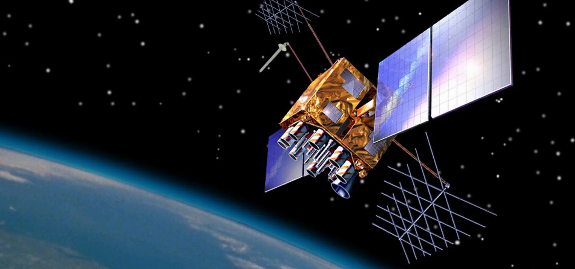
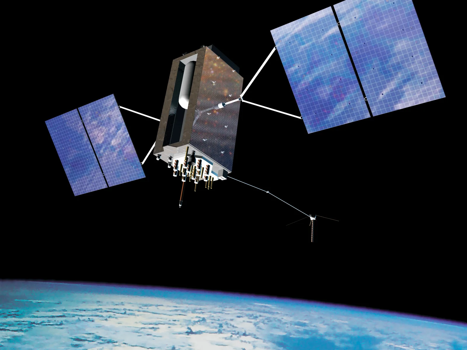
GPS III navigation satellite in orbit above the Earth, part of the GNSS constellations used by marine receivers

GPS and GNSS explained

Marine GPS and GNSS navigation systems

Marine GPS is an essential component of modern bridge navigation systems. It receives signals from navigation satellites to determine the vessel's geographical position and provide accurate navigation information.

While GPS refers specifically to the United States satellite navigation system, GNSS (Global Navigation Satellite System) is the broader term covering several satellite constellations, including:

  • GPS: Global Positioning System of the United States
  • Galileo: European satellite navigation system
  • GLONASS: Russian satellite navigation system
  • BeiDou: Chinese satellite navigation system

Modern marine GNSS receivers can use multiple satellite constellations to improve satellite availability and positioning reliability. More visible satellites mean a more stable fix, better geometry and a backup when one system is degraded.

The information generated by these receivers can be distributed to other onboard navigation and communication systems, which is why a correct installation matters for the whole bridge and not only for the GPS display itself.

Installation

Marine GPS installation and commissioning

Correct installation of a marine GPS or GNSS system is important for reliable navigation data throughout the vessel.

Installation involves more than mounting a receiver and connecting an antenna. Antenna positioning, cable routing, power supply, equipment configuration and communication with other bridge systems all influence performance.

Depending on the equipment and project, the work may include

  • GPS and GNSS receiver installation
  • GPS antenna installation and replacement
  • Antenna cable routing and termination
  • Power supply and connection checks
  • NMEA 0183 and NMEA 2000 interface connections
  • IEC 61162 and Ethernet-based data integration
  • GPS data configuration and distribution
  • Position, speed and time verification
  • Functional testing and commissioning

Correct integration helps ensure that connected navigation systems receive valid and consistent positioning information.

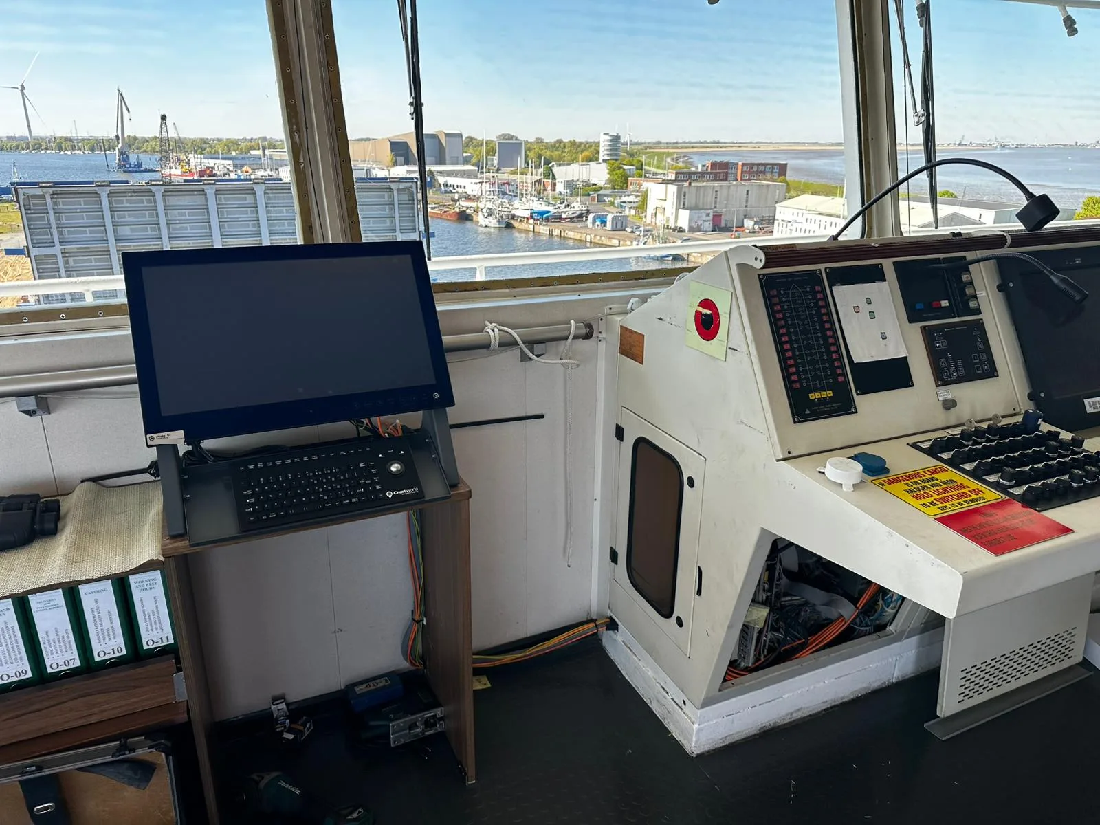
Navigation equipment installation on a cargo ship bridge, with the console opened for cabling and interface connections

Integration

GPS integration with ECDIS, AIS and other navigation equipment

A marine GPS receiver often supplies important navigation data to several systems onboard. These may include:

  • ECDIS: uses position information to display the vessel's location on electronic navigational charts and support route monitoring.
  • AIS: uses positioning information as part of the vessel data transmitted to other ships and shore stations.
  • Radar: may use GPS-derived position, speed over ground and course over ground information for supported navigation functions.
  • GMDSS: compatible distress communication equipment can use GNSS data to include the vessel's position in emergency alerts.
  • VDR: records relevant navigation data, including available position information.

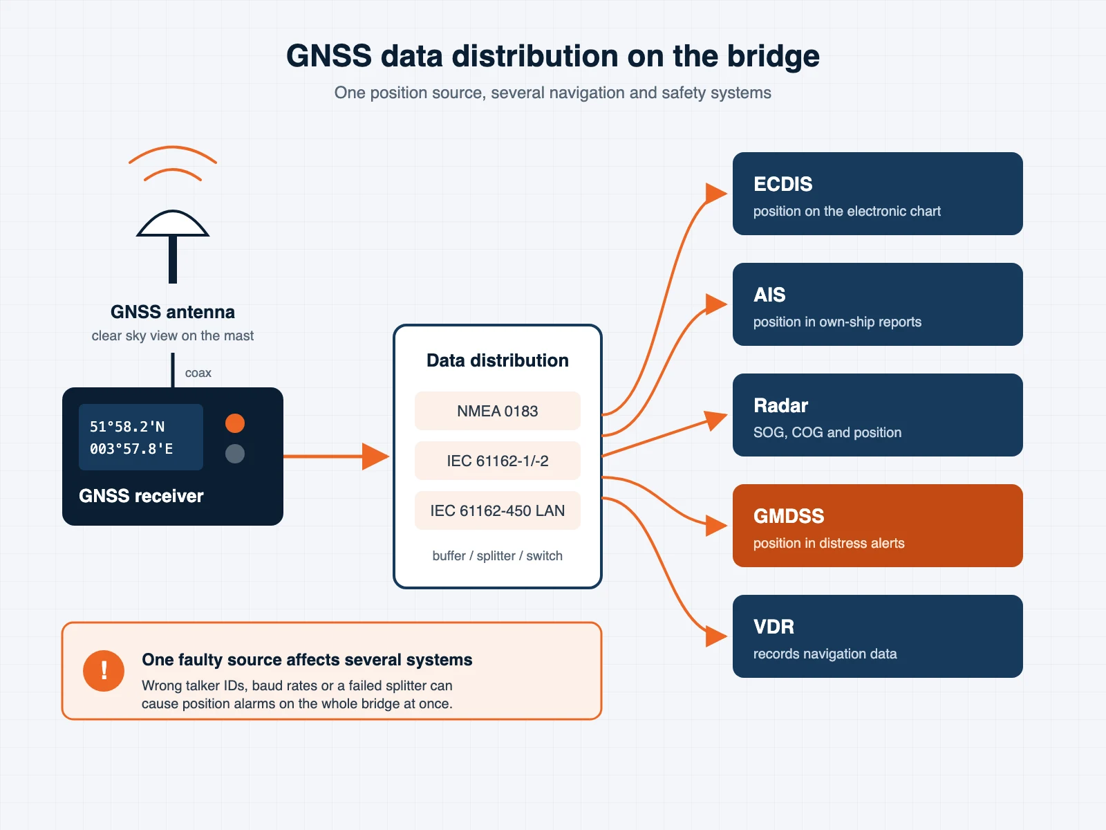
Because multiple systems can depend on the same positioning source, GPS faults or incorrect data distribution can affect several bridge systems simultaneously. When we install or repair a receiver, we therefore check the data on every connected system, not only on the GPS itself.

Related services: ECDIS installation and commissioning and GMDSS systems.

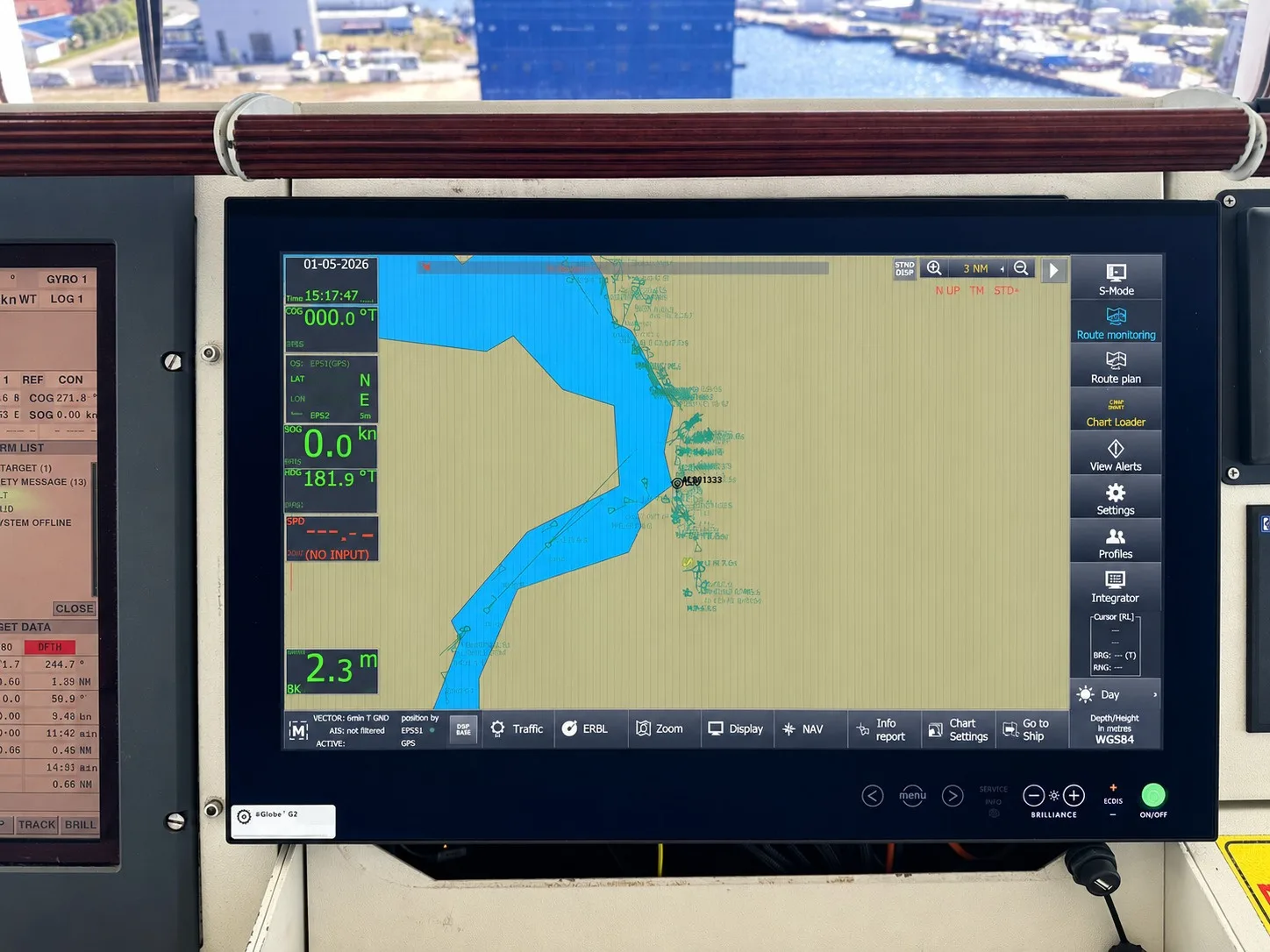
ECDIS display in route monitoring mode showing the GNSS position, heading, speed and depth of the vessel

Regulations

SOLAS requirements for marine GPS and GNSS equipment

Marine positioning equipment plays an important role in meeting international navigation safety requirements.

Under SOLAS Chapter V, Regulation 19.2.1.6, ships within the scope of the regulation must have a suitable means of automatically establishing and updating their position throughout the intended voyage. This may be achieved through an appropriate GNSS receiver, terrestrial radionavigation equipment or another acceptable positioning solution.

SOLAS Chapter V, Regulation 18 also addresses type approval and applicable performance standards for required navigational equipment.

Relevant IMO standards

  • IMO Resolution MSC.112(73): performance standards for shipborne GPS receiver equipment.
  • IMO Resolution MSC.401(95): performance standards for multi-system shipborne radionavigation receivers.

Equipment selection and installation should take account of the applicable SOLAS requirements, flag State regulations and relevant approval standards. The exact requirements may depend on the vessel, its operating area and the flag Administration.

Signal security

GPS signal interference, jamming and spoofing

Reliable satellite positioning is increasingly important as modern navigation systems become more interconnected. However, satellite navigation signals can be affected by interference.

Two important risks

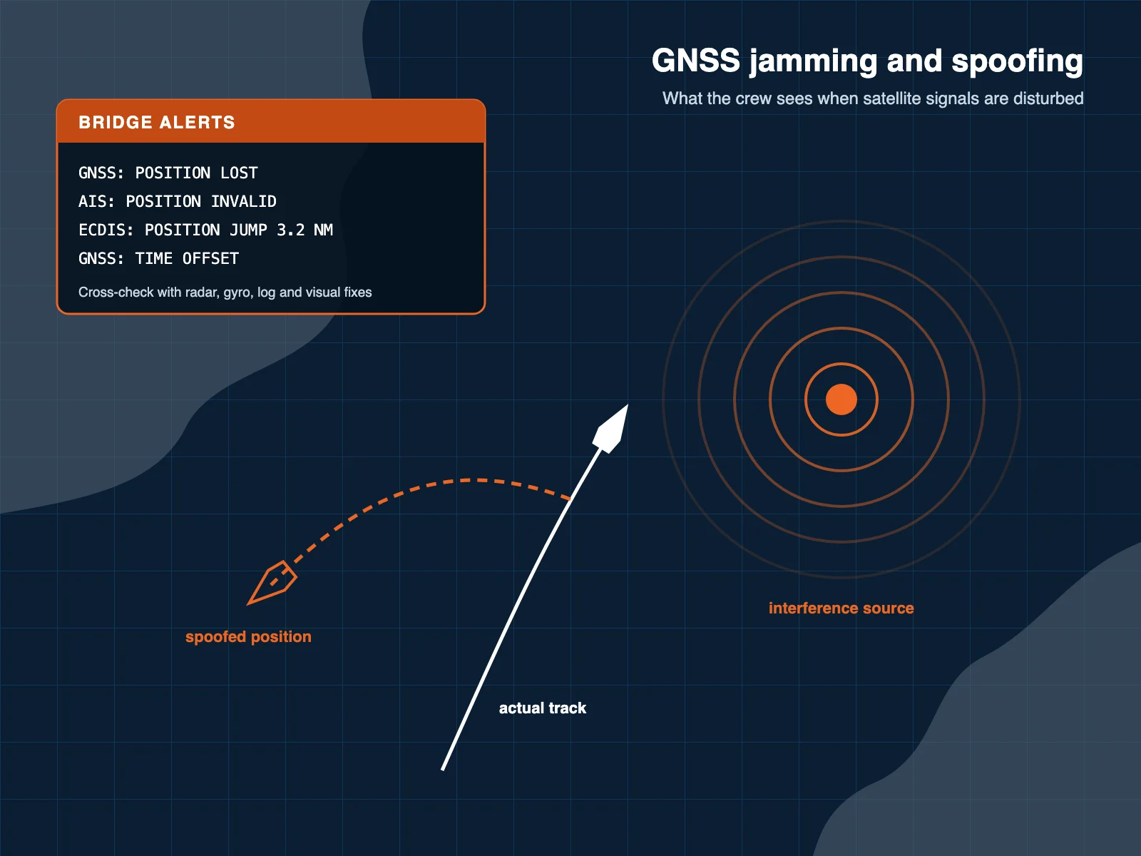
  • GPS jamming: radio interference that prevents or reduces the receiver's ability to obtain reliable satellite positioning information.
  • GPS spoofing: the transmission of misleading satellite-like signals that may cause a receiver to calculate an incorrect position or time.

These disruptions can affect navigation equipment that relies on GNSS data, such as ECDIS, AIS and GMDSS.

Using suitable multi-system receivers, monitoring position integrity and maintaining appropriate independent navigation methods can help improve operational resilience.

Electronic chart illustration of GPS jamming and spoofing: interference source, spoofed ship position and bridge alerts for lost position

Technical support

Marine GPS and GNSS technical support

Satcenter supports shipowners, ship managers, maritime equipment suppliers and technical management companies with onboard engineering services.

Onboard experience

Practical experience in marine communication, onboard networks and bridge equipment integration.

Rotterdam and Türkiye

Engineering resources in the Netherlands and Türkiye, supporting vessels across Europe and the Middle East.

Port call planning

Service attendance coordinated with port calls, scheduled maintenance and vessel upgrades.

One point of contact

Clear communication with the superintendent and the crew, from the first question to the test report.

Fault finding

Common GPS problems onboard

Positioning problems usually show up first as alarms on ECDIS or AIS. Our engineers check the complete chain from antenna to every connected system to find the real cause.

  • No position or lost fix: damaged antenna, water in connectors or a broken coax cable
  • Unstable or jumping position: poor antenna location, interference from nearby transmitters or degraded signals
  • Data missing on one system: wrong interface settings, baud rate or sentence configuration
  • Alarms on several systems at once: a failed distribution unit, splitter or power supply
  • Wrong time or date: receiver configuration or firmware issues

The same engineers also support navigation and communication systems, Starlink and VSAT connectivity, so several jobs can be combined in one port call.

Diagram of GNSS data distribution on a ship bridge from antenna and receiver over NMEA 0183 and IEC 61162 to ECDIS, AIS, radar, GMDSS and VDR

FAQ

Marine GPS and GNSS: frequently asked questions

Answers to the questions we hear most from shipowners and superintendents about positioning equipment.

Still have questions?

Our engineers are happy to help.

Contact an engineer

GPS is the United States satellite navigation system. GNSS is the general term for all satellite navigation systems, including GPS, Galileo, GLONASS and BeiDou. A multi-constellation GNSS receiver can use several of these systems at the same time.

Typically ECDIS, AIS, radar, GMDSS equipment and the VDR. Depending on the vessel, other systems such as the autopilot or onboard satellite communication terminals may also use GNSS position or time.

SOLAS Chapter V, Regulation 19.2.1.6 requires ships within its scope to have a means of automatically establishing and updating their position throughout the voyage. A type-approved GNSS receiver is the usual way to meet this, subject to flag State requirements.

In most cases, yes. We check the existing interfaces and data formats, connect the new receiver to the existing systems and verify that ECDIS, AIS, radar and the other connected equipment receive correct data.

Multi-system receivers, position integrity monitoring and independent navigation methods such as radar, gyro and visual fixes all help the crew detect and handle disturbed satellite signals.

Get in touch

Need assistance with a marine GPS or GNSS system?

Contact Satcenter to discuss GPS installation, receiver replacement, data integration or troubleshooting requirements onboard your vessel. Send us the vessel type, the port and expected dates and a short description of the job or the fault, or email our technical team at service@satcenter.tv.

  • Call us 24/7+31 85 560 71 20
  • Emailinfo@satcenter.tv
  • Head OfficeKortebrantstraat 7A
    3031 PM Rotterdam
    The Netherlands
  • Türkiye OfficeEsentepe, Yüzbaşı Kaya Aldoğan Sk. No:4
    34394 Şişli / İstanbul
    Türkiye

Send us a message

We usually reply within one business day.

Our Blog

View all